Joshua Tree National Park is named after the Joshua trees (Yucca brevifolia) native to the Mojave Desert. Originally declared a national monument in 1936, Joshua Tree was redesignated as a national park in 1994. It is slightly larger than the state of Rhode Island.
The park includes parts of two desert ecosystems: the higher-elevation (3,000–6,000 ft) Mojave Desert and the lower-elevation (below 3,000 ft) Colorado Desert. The dominant geologic features of the Mojave Desert are hills of bare rock, usually broken up into loose boulders. These hills are popular with rock climbing and scrambling enthusiasts. The flatlands between the hills are sparsely forested with Joshua trees.
It is forecasted that by 2099, the park's temperature will increase by 8 °F, making much of the park unsuitable for Joshua tree growth.
The Colorado Desert encompasses the eastern part of the park and features habitats of creosote bush scrub, ocotillo, desert saltbush, and mixed scrub including yucca and cholla cactus. The California fan palm, the only palm native to California, also occurs naturally in five oases within the park.
約書亞樹國家公園以原產於莫哈韋沙漠(Mojave Desert)的約書亞樹(Joshua tree)命名。約書亞樹國家公園最初於 1936 年被宣佈為國家紀念碑,並於 1994 年重新指定為國家公園。它的面積略大於羅德島州。
公園包含兩個沙漠生態系統的部分區域:海拔較高的莫哈韋沙漠(3,000-6,000 英尺)和海拔較低的科羅拉多沙漠(3,000 英尺以下)。莫哈韋沙漠的主要地質特徵是光秃秃的岩石丘陵,通常破碎成鬆散的巨石。這些丘陵深受攀岩和攀岩愛好者的喜愛。丘陵之間的平地上稀疏地生長著約書亞樹。
根據預測,到 2099 年,公園的溫度將上升 8°F,使得公園的大部分地區不再適合約書亞樹生長。
科羅拉多沙漠覆蓋公園東部,生長著木餾油灌木、福桂樹、沙漠濱藜以及包括絲蘭和仙人掌在內的混合灌木叢。絲葵(加州扇形棕櫚)是加州唯一的原生棕櫚樹,也自然生長在公園內的五個綠洲中。


Park Map
Click here for Interactive Park Map from National Park Service

Cholla Cactus Garden Nature Trail 仙人掌花園自然步道
The Cholla Cactus Garden Nature Trail is an easy 0.25-mile loop located off Pinto Basin Road. The trail leads you through a nearly 10-acre landscape dominated by the teddy bear cholla. These cacti are covered in spines that can latch onto your skin, shoes, or clothes with the slightest touch — which is why they are also called “jumping cholla.” Be sure to watch your step, but don’t let that stop you from enjoying the trail.
仙人掌花園自然步道位於平托盆地 (Pinto Basin) 路旁,是一條 0.25 英里長的環形步道,輕鬆便捷。步道將帶您穿越近 10 英畝的景觀,其中以泰迪熊仙人掌為主。這些仙人掌全身長滿刺,輕輕一碰就能扎進您的皮膚、鞋子或衣服上——因此它們也被稱為「跳躍仙人掌」。請務必小心,但是並不該因而讓你怯步不去。


The spot where Mojave Desert and Colorado Desert meets


Arch Rock Nature Trail and Heart Rock 拱石自然步道及心形岩
We stopped at Twin Tanks, located along Pinto Basin Road, and took a short 1.4-mile hike on the Arch Rock Nature Trail. Although I didn’t see Arch Rock, I still enjoyed the unique rock formations and the abundance of Joshua tree blooms.
我們在平托盆地路(Pinto Basin Road)旁的雙子水箱(Twin Tanks)稍作停留,然後沿著拱門岩自然步道走了 1.4 英里。雖然我沒有看到拱門岩,但我仍然欣賞著它獨特的岩石和盛開的約書亞樹花。


Skull Rock 頭骨岩
From the accumulation of raindrops in tiny depressions to the erosion of granite, followed by more water accumulation and continued erosion, two hollowed-out eye sockets eventually formed—causing the rock to resemble a skull. Skull Rock Trail is a 1.7-mile nature trail. We didn't walk the trail but stopped to take a few pictures. (Note: The last two photos were taken on November 25, 2018.)
從雨滴積在小窪坑,到花崗岩的侵蝕,再到更多的水積聚和持續的侵蝕,最終形成了兩個掏空的眼窩,使岩石看起來像一個骷顱頭。頭骨岩步道是一條 1.7 英里長的步道。我們沒有走這條步道,只是停下來拍了幾張照片。 (註:最後兩張照片拍攝於 2018 年 11 月 25 日。)


A random place where we saw people rock climbing


Barker Dam 巴克大壩
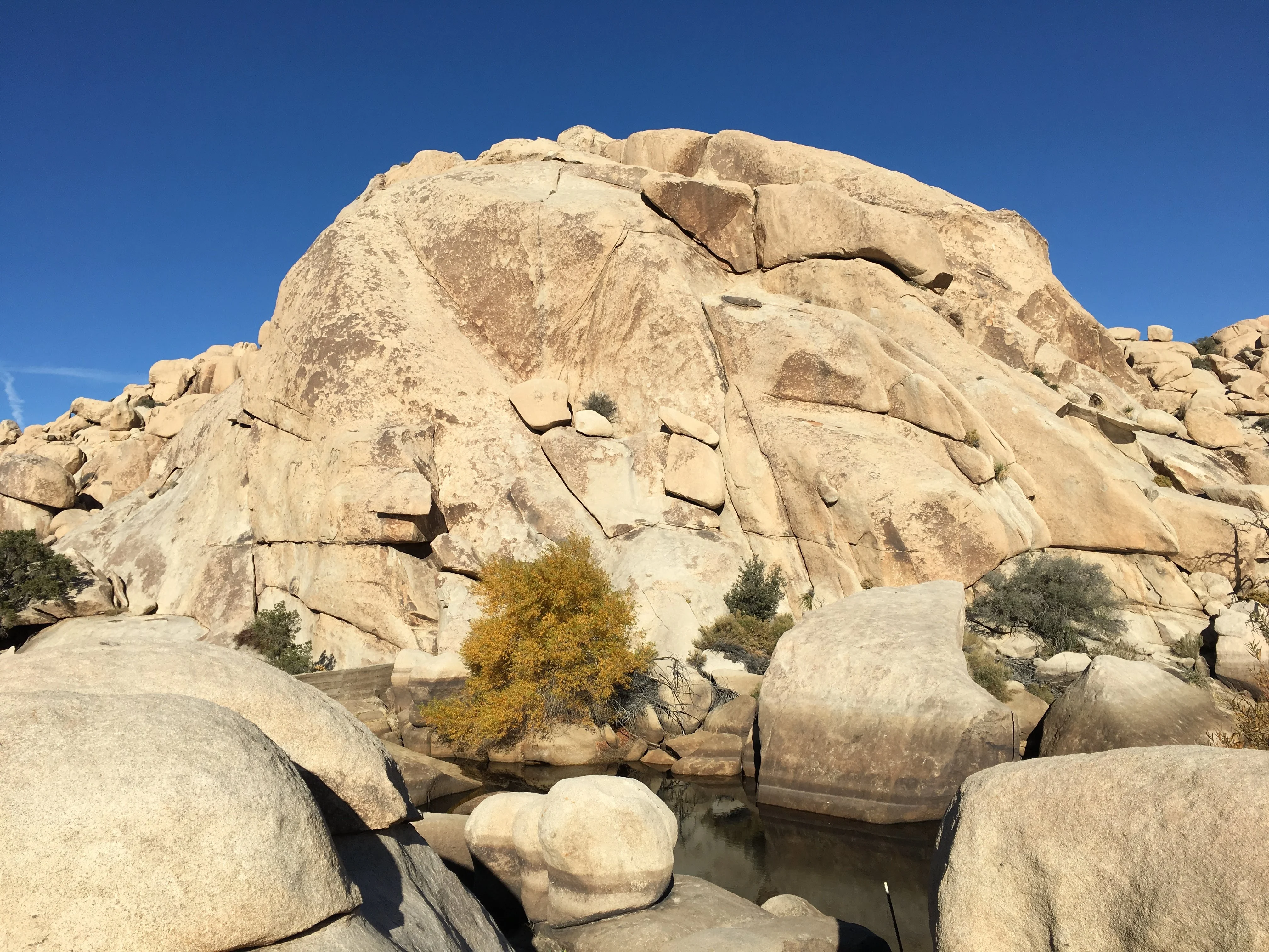
Barker Dam, also known as Big Horn Dam, is a dam with a water-storage reservoir that was originally constructed in 1900 for cattle and mining purposes. The Barker Dam Trail is an easy 1.1-mile (1.8 km) loop trail.
巴克大壩,又稱大角壩,是一座帶有蓄水池的大壩,最初建於 1900 年,用於放牧牲畜和採礦。巴克大壩步道是一條 1.1 英里(1.8公里)長的環形步道,輕鬆易行。


Hidden Valley Trail 隱谷自然步道
The Hidden Valley Nature Trailhead is located just off Park Boulevard. It is an easy one-mile loop through Hidden Valley on a dirt and rock trail.
隱谷自然步道的起點就在公園大道 (Park Boulevard) 旁。這是一條一英里長的環形步道,沿著泥土和岩石步道穿過隱谷,十分輕鬆。


Keys View
Situated on the crest of the Little San Bernardino Mountains, this trail is a fully paved 500-foot (150 m) loop. From the top, you’ll have a spectacular view of the Coachella Valley, the Salton Sea, Mt. San Jacinto, Mt. San Gorgonio, and the San Andreas Fault.
這條步道位於小聖貝納迪諾山的山頂,是一條 500 英尺(150 公尺)長的環形步道。從山頂,您可以欣賞到科切拉谷、索爾頓湖、聖哈辛託山、聖戈爾戈尼奧山和聖安德烈亞斯斷層的壯麗景色。


Flashback 回顧


References 參考資料
- National Park Service, Joshua Tree National Park: Arch Rock, Barker Dam Trail, Cholla Cactus Garden, Hidden Valley Nature Trail, Keys View, Skull Rock Trail
- USGS (United States Geological Survey): Joshua Tree National Park Ecology
- AllTrails: Arch Rock Trail, Barker Dam, Cholla Cactus Garden, Hidden Valley, Keys View, Skull Rock
- Wikipedia: Barker Dam (California)
Other Related Post 其他相關的帖子
Other Travel/Point of Interest Links 其他旅遊景點連結

Comments